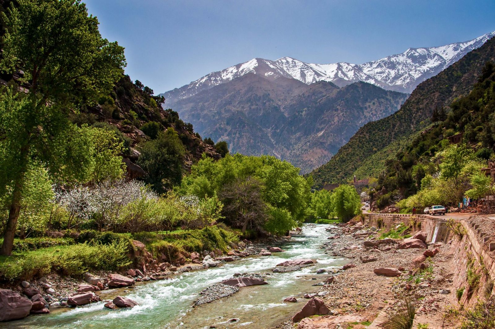
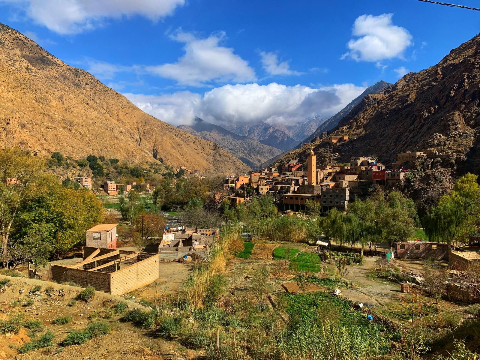
Ourika Valley

- First waterfall 20 to 30 minutes uphill from the village
- Steep, rocky path, footbridges without handrails, a few hands-on moves
- Full seven-falls loop: about 7.2 km and 488 m of ascent on a Wikiloc track
- Strongest flow in spring, from the snowmelt
- Summer storms can raise the river very fast: walk in the morning
- Official local guides at the start of the path
Short answers
Where does the Setti Fatma waterfalls hike start?
The Setti Fatma waterfalls hike starts at the footbridges of Setti Fatma, the last village on the Ourika Valley road, at about 1,500 m, near the official guides' office. From there the path climbs a narrow gorge lined with seven falls stacked one above the other; the first and largest is the goal for most visitors.
How long does it take to reach the first Setti Fatma waterfall?
The first Setti Fatma waterfall is 20 to 30 minutes of steep, rocky climbing from the village, with a few moves where you use your hands. The return trip takes about 1 to 1.5 hours at an easy pace, stops included. The full seven-falls loop is about 7.2 km with 488 m of ascent, a half day with a guide.
Do you need a guide for the Setti Fatma waterfalls, and how much does it cost?
A guide is not compulsory as far as the first Setti Fatma waterfall, but recommended, and necessary beyond it. On our private day trip a valley guide costs 40 EUR per group for 1 to 7 people and 80 EUR for 8 to 17. Wikivoyage reports undated village offers of 100 to 150 dirhams to the first fall.
When do the Setti Fatma waterfalls have the most water?
The Setti Fatma waterfalls are strongest in spring, roughly March to May, when snowmelt from the High Atlas fills the river; by late summer the first fall can be a thin stream. In July and August, afternoon thunderstorms can raise the stream within minutes, so walk in the morning and head down if the water turns brown.
The Setti Fatma waterfalls hike climbs a narrow gorge above Setti Fatma, the last village on the Ourika Valley road, at about 1,500 m in the High Atlas, to a series of seven falls stacked one above the other. The path leaves from the village footbridges and reaches the first fall, the largest, in 20 to 30 minutes of steep, rocky climbing, with the odd move where you use your hands. Most visitors stop there; the viewpoint just above and the upper falls, smaller and wilder, are for strong walkers with a local guide. A Wikiloc track puts the full seven-falls loop at about 7.2 km with 488 m of ascent. The water is strongest in spring, roughly March to May, when the snow melts, and drops sharply by late summer. In July and August, afternoon thunderstorms can raise the stream within minutes, so walk in the morning. Closed shoes with a good grip, water and some cash are enough; a guide is not compulsory as far as the first fall, but recommended.
We have walked this gorge in every season, with families, groups of friends and grandparents who wanted to "just see the first one". Here is what we tell every guest before they start, stretch by stretch.
The Setti Fatma waterfalls hike at a glance
| Point | What to know |
|---|---|
| Start | Setti Fatma footbridges, about 1,500 m, near the official guides' office |
| To the first fall | 20 to 30 minutes of steep climbing, longer on busy days |
| To the viewpoint | About 10 more minutes, an almost vertical scramble |
| To the highest fall | About another hour, hard going, with a guide only |
| Seven falls loop | About 7.2 km and 488 m of ascent (Wikiloc track) |
| Return trip to the first fall | About 1 to 1.5 hours at an easy pace, stops included |
| Terrain | Stone steps, dirt, large boulders, footbridges without handrails, wet rock |
| Guide | Recommended to the first fall, necessary beyond |
| Best time | Morning, and spring for the water |
| Avoid | Stormy summer afternoons, a river that turns brown or rises |
Where does the waterfall hike start?
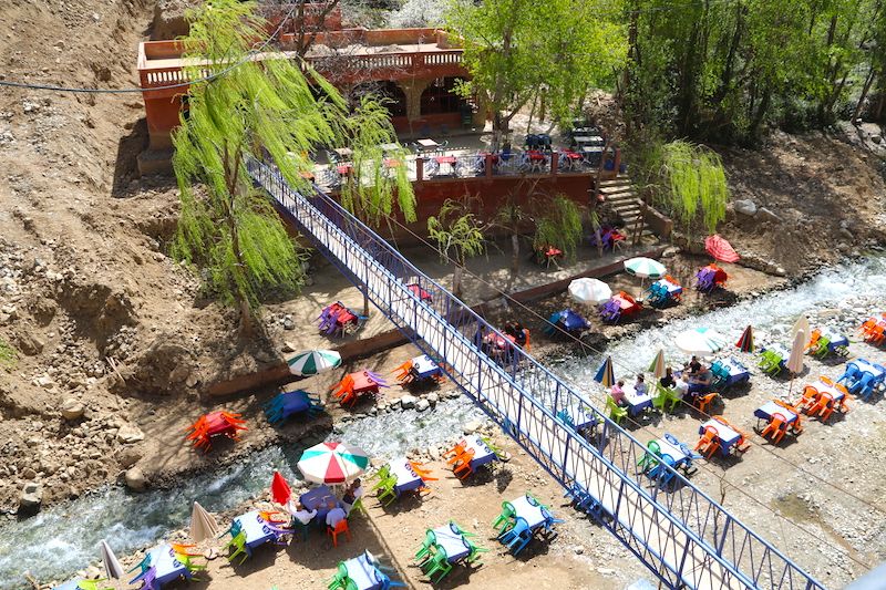
The hike starts in Setti Fatma, the last village on the Ourika Valley road, at about 1,500 m and about 63 km from Marrakech by road. You cross the river on a footbridge, walk past the restaurants on the far bank and head up the side valley into the gorge. The official guides' office sits near the bridge.
Just above the village the path narrows, the walls of the gorge close in, and you hear the water before you see it. The seven waterfalls are spread along this gorge, one above the other. The lowest ones are by far the most visited, and they are the ones most photos show.
Step by step, from the village to the first fall
Allow 20 to 30 minutes from the village to the first fall. Lonely Planet calls it a "steep 20-minute hike"; with average walkers we count closer to half an hour, a little less on the way down if the path is quiet, more on a busy weekend. One traveller carrying his daughter in a baby carrier took about an hour, according to his account on World of Waterfalls. It is short, but each stretch has its own character.
Step 1: crossing the river on the footbridges
You leave the road, cross the river on one of the village footbridges and follow the water upstream. Wikivoyage notes that the route is marked with blue arrows through the main part of the village. The footbridges are often simple planks with no handrail over fast water: watch your feet, hold children by the hand, and do not stop in the middle for a photo when people are waiting behind you.
Step 2: the steps and the stalls
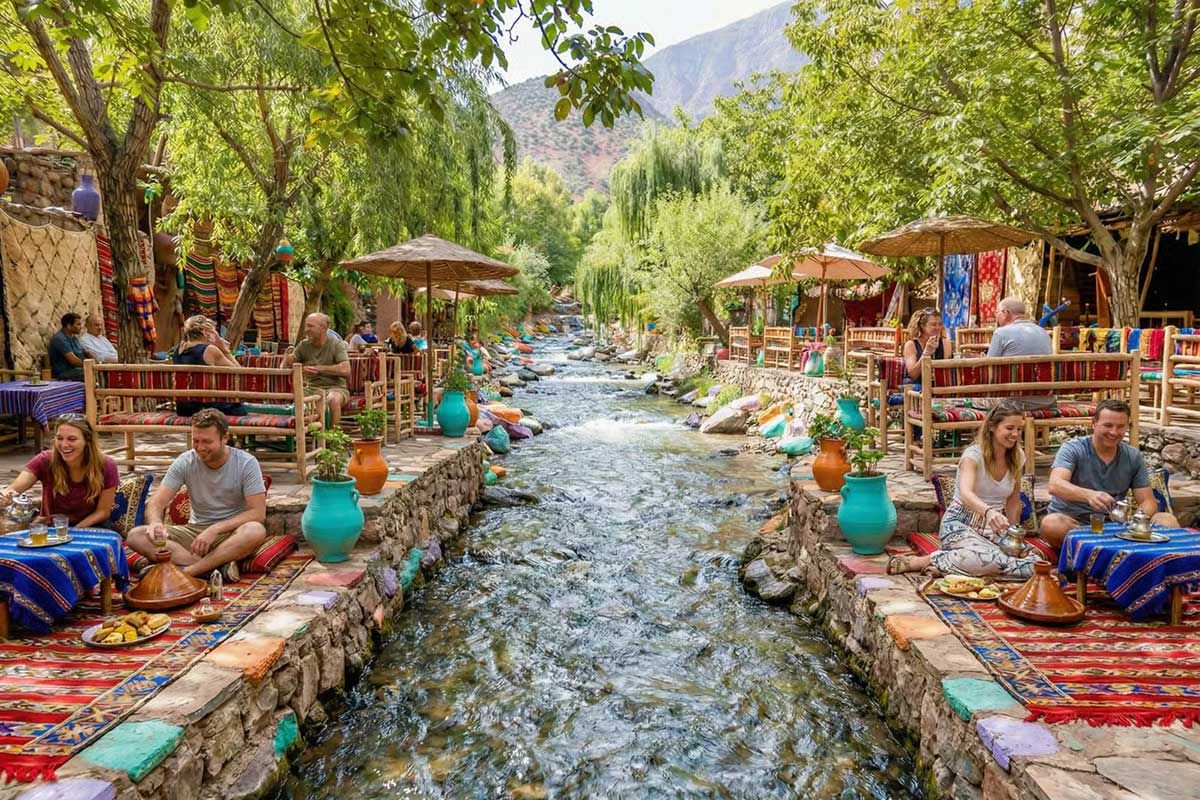
The path then climbs a series of uneven stone steps and dirt tracks. Up to about halfway it is lined with cafés, drinks and fruit stands and small souvenir shops. This is the easiest stretch and the liveliest. The little cafés clinging to the rocks serve fresh orange juice, soft drinks and tea, ideal for a pause in the shade, especially on the way back.
On the way, look out for the small channels that divert part of the water alongside the falls. This irrigation know-how is old, and the guides enjoy explaining how it works.
Step 3: the boulders and the hands-on moves
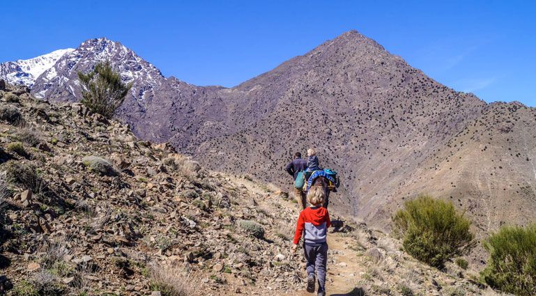
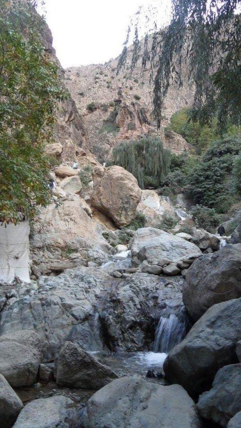
Higher up, the dirt gives way to rock. Three things make the climb harder than the distance suggests:
- It is steep. The path gains height quickly on uneven stone steps and loose gravel.
- It is rocky. In several places you step up onto large boulders, and a few moves need your hands. Nothing technical, but you want both hands free, so use a small backpack rather than carrying bags.
- It gets wet. Near the falls, spray and small streams keep the rocks damp and slippery, even in summer.
On busy days this is where the queues form: you wait your turn at the narrow passages. Do not overtake by clinging to the edge, and let people coming down go first where only one person fits.
Step 4: the last footbridge and the first fall
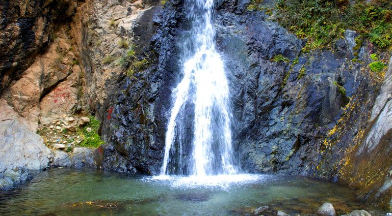
The final step before the fall crosses a narrow footbridge over a cascade, and then you come out at the foot of the first fall, the lowest and largest of the seven. The water drops into a pool ringed with boulders where people sit, cool their feet and take photos. There is a café right next to the fall. For many families this is the goal of the day, and a very good one.
Above the first fall: the viewpoint and the upper falls
The viewpoint
From the first fall, an almost vertical ten-minute scramble leads to an eyrie-like viewpoint with a drinks stall, according to Lonely Planet. From up there you can see the first fall and at least two others, which finally gives you the scale of the gorge. This stretch is steeper and more exposed than anything below, and coming down from the viewpoint is trickier than going up. If you hesitate on the way up, turn back: you will have to come down the same way.
On to the seventh fall
Above, the path becomes rougher, less marked and much quieter. The upper falls are smaller, but the setting is wilder, with views straight down the gorge and very few people. Lonely Planet allows "a gruelling hour" more to reach the base of the highest fall, which is also the smallest. That means more hands-on moves, places where the path merges with the stream bed, and a careful descent on the same ground. Reaching the highest falls is a proper outing, for fit, sure-footed walkers only.
Our advice is simple: beyond the first falls, go only with a local guide, start in the morning, carry water, and turn back at the agreed time even if the next fall looks close. The path is easy to lose, and the descent is always harder on tired legs.
How hard is the hike, really?
It depends on how far you go. The walk to the first fall, 20 to 30 minutes up, is moderate and fine for anyone of normal fitness in good shoes. The viewpoint, 10 minutes higher, is a near-vertical scramble, and the hour beyond to the highest fall is hard going, with a guide only.
The question comes up with every booking. The Setti Fatma waterfalls hike is not "easy" or "hard": it gets harder the higher you climb.
| Stretch | Rough time going up | Difficulty | Suitable for |
|---|---|---|---|
| Village and footbridges | Start of the climb | Easy, mind the footbridges without handrails | Everyone, baby carriers included |
| Steps and stalls | Middle section | Easy to moderate, high steps | Any walker |
| Boulders before the first fall | Last stretch (20 to 30 minutes in all from the village) | Moderate, hands on rock, wet rock | Children who walk well, adults of normal fitness |
| First fall to the viewpoint | About 10 minutes | Hard, almost vertical scramble | Sure-footed walkers, with a guide |
| Viewpoint to the highest fall | About an hour | Hard, faint path, stream bed | Strong walkers, with a guide only |
The times for the viewpoint and the upper falls come from Lonely Planet and are rough figures for a group of normal fitness on a quiet day. Allow about the same time coming down: on this ground, descending is not much faster than climbing. The World of Waterfalls traveller spent nearly three hours in all on the route including the viewpoint: an hour up, an hour at the top, an hour down.
What tires you is not the distance but your knees and your balance. If you rarely walk, suffer from vertigo or have a weak ankle, aim for the first fall, take your time and let the guide give you a hand on the wet passages.
When do the waterfalls have the most water?
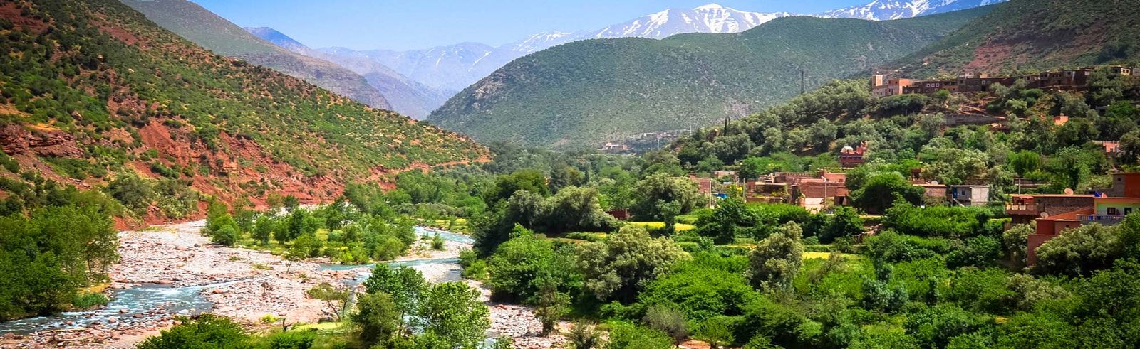
The falls are at their strongest in spring, roughly March to May, when snowmelt from the High Atlas peaks fills the river. Flow drops through summer, and by September or October, after a dry year, the first fall can be a thin stream. Winter brings moderate water but cold, sometimes icy rock.
The flow changes a lot through the year:
- Spring (roughly March to May) is the best time. The snowmelt fills the river, the falls are at their strongest and the orchards in the valley are green or in blossom; Lonely Planet suggests early March for the almond and cherry blossom.
- Early summer is still good, with pleasant cool air in the gorge, although the flow drops.
- Late summer and early autumn can be low: after a dry year, the first fall may be only a thin stream. It is still a lovely walk, but do not expect a torrent.
- Winter can be cold and wet, with occasional ice on shaded rocks after cold nights. Clear winter days, with snow on the peaks above, are beautiful but need extra care.
Our Ourika Valley weather guide goes into the conditions month by month.
Water flow at the Setti Fatma falls, month by month
This table sums up what we usually see at the first falls. It is a general pattern, not a measurement: the flow depends on the snow and rain of each year, and it can change within a day after a storm.
| Month | Typical flow | Note |
|---|---|---|
| January | Moderate | Rain and snow on the peaks feed the stream; cold, with occasional ice on shaded rocks after cold nights |
| February | Moderate | Still cold, more rain possible |
| March | High | The stream rises with the snowmelt; showers, and the river can be too high to cross on some days after heavy rain |
| April | High | The strongest falls of the year, in the middle of the snowmelt |
| May | High | The river is still high and the days are mild |
| June | Good | The flow starts to drop, the gorge stays cool |
| July | Moderate | Lower than in spring; sudden rises after afternoon thunderstorms |
| August | Low to moderate | The month of the most frequent storms: the water can rise and turn brown within minutes |
| September | Low | After a dry year the first fall may be only a thin stream; storms still possible early in the month |
| October | Low | Usually the lowest water of the year, before the autumn rains |
| November | Low to moderate | The first rains bring some water back |
| December | Moderate | Snow returns to the peaks; cold mornings |
For the strongest water, come between March and May. From July to September, come for the walk and the cool gorge more than for the falls themselves, and walk in the morning. No two years are alike: in early October 2026, after several days of storms, the falls were carrying a lot of water, as we explain in our update on the valley reopening.
Flash floods and summer storms
This is the one safety point we insist on. In July and August, heat building over the mountains often produces thunderstorms in the afternoon. Rain falling high up can send a surge of water down the gorge within minutes, sometimes while the sky above Setti Fatma still looks fine. The valley learned this the hard way in the flood of August 1995, which killed more than 200 people.
The waterfall path follows the stream, which is exactly where the water rises first. In practice:
- Walk in the morning in summer, and aim to be back down in the village by early afternoon.
- If a storm is forecast for the afternoon, do not go up: stay in the villages and cooperatives, away from the riverbed.
- If you hear thunder, see dark clouds over the peaks, or notice the water turning brown or rising, leave the riverbed and come down straight away.
- Do not cross footbridges or fords while the water is rising.
- Never wait out a storm in the bottom of the gorge or on rocks in the river.
- Listen to the guides and café owners. When they say go back, they mean it.
A flash flood passes quickly: it is better to wait an hour on high ground than to risk a crossing. Our page on the October 2026 storms and floods explains why the Ourika rises so fast.
We watch the forecast before every departure. If the river or the weather makes the valley unsafe, we propose another date or a full refund.
What to wear and bring
- Shoes: trainers or walking shoes with a good grip. No flip-flops or smooth-soled sandals, even if you see them on the path. Water shoes are fine if they have a solid sole.
- Clothes: light, comfortable, covering shoulders and knees in the village. Bring a layer: the gorge is cooler than the road, especially in spring and autumn.
- Bag: a small backpack so your hands stay free.
- Water and sun: a bottle of water, sunscreen and a hat for the open stretches.
- Cash: small notes for drinks, your guide and a tip.
- Phone protection: a waterproof pouch for the spray near the falls.
- Walking poles: useful for the descent if your knees are sensitive; stow them in your bag on the hands-on passages.
Kids and older travellers
Children who walk regularly usually love the scramble between the boulders and the pools. Keep young children close on the rocky steps, on the footbridges and at the water's edge. Our guides are used to helping kids over the tricky spots. For toddlers, a baby carrier works as far as the first fall; a pushchair is useless beyond the village. The viewpoint and the upper falls are no place for a baby carrier: the World of Waterfalls traveller, who was carrying his daughter, admits himself that it was a bit risky given the exposed passages.
For older travellers, the question is balance and knees, not distance. Some steps are high and the descent is the trickiest part. Walking poles help a lot. If the full climb seems too ambitious, the stretch along the river near the village and a long lunch at a riverside table already make a very good day. Our page on the Ourika Valley with kids has more ideas for a family day out.
Why we recommend a local guide
A guide is not compulsory as far as the first fall, but on this path it is worth the money. The village guides know which route is dry, where the rock is loose that week and how the river is behaving. They also make the walk richer: the plants and birds of the gorge (more in our guide to Ourika's nature and wildlife), the villages above, the stories of the gorge. On our Ourika Valley day trip you can add a local valley guide when you book (40 EUR per group for 1 to 7 people, 80 EUR for 8 to 17), who walks with you. Our guides page introduces the people who work with us.
If you come independently, go to the official guides' office rather than the touts on the road. Wikivoyage mentions, without a date, offers of 100 to 150 dirhams to the first fall; we found no official published rate. Before you set off, agree the price, the fall where you will turn back and the time you will be back.
| Option | Price | What is included |
|---|---|---|
| Local guide on our private day trip or our half day | 40 EUR per group for 1 to 7 people, 80 EUR for 8 to 17 | A valley guide who walks with you to the falls |
| Guide from the official Setti Fatma office | Agreed on the spot | Depends on the route you agree with him |
| No guide | Free | First fall only, in safe weather |
The most common mistakes
- Starting at midday on a summer Saturday. The path is packed, the heat is strong and storm time is approaching.
- Climbing in flip-flops. Wet rock and footbridges are exactly where the sole matters.
- Carrying a bag in your hand. You will need both hands on the boulders.
- Going on "just to the next one". Coming down from the viewpoint and the upper falls takes as long as going up.
- Following the first guide who approaches you. Use the official office or book the guide with your trip.
- Ignoring the colour of the water. Water that turns brown or rises means it is raining higher up: head down.
Swimming in the pools
On hot days you will see people in the pools below the falls. It can be refreshing, but be careful: the water is very cold even in August, the rocks are slippery, depth is deceptive and currents under the falls are stronger than they look. Do not jump from the rocks, never swim alone, keep children out of the deep parts and get out as soon as the water changes colour.
Photo tips
The gorge is deep and narrow, so light is best from late morning, when the sun reaches the water. A wide angle captures the whole fall; a slower shutter speed smooths the water if you can steady the camera on a rock. Keep your phone in a pouch between shots, and ask before photographing people from the village, including the café owners.
The waterfalls combine easily with the rest of the valley: see our list of things to do in the Ourika Valley, our guide to hiking in the Ourika Valley for walks between villages, or our packages if you want to add a camel ride or a trek with lunch in a Berber family.
Sources
- Wikipedia, Ourika Valley (about 30 km from Marrakesh, Setti Fatma as last town on the paved road, Monday souk)
- Lonely Planet, Setti Fatma (20 minutes to the lowest and largest fall, a 10-minute scramble to the viewpoint and its drinks stall, another hour to the highest, blossom in early March; in French)
- Wikivoyage, Setti Fatma (blue arrows in the village, footbridges, wet stepping stones, guide offers of 100 to 150 dirhams to the first fall, official guides' office)
- World of Waterfalls, Cascades de Setti Fatma (account of a visit in May 2015: footbridges without handrails, cafés up to halfway, about an hour up with a baby carrier, viewpoint, nearly three hours in all)
- Wikiloc, hiking trails in Setti Fatma: distance and ascent of the seven waterfalls loop
- Saidi et al. (2010), The Ourika floods (High Atlas, Morocco), Comunicações Geológicas 97 (summer storms, flood rise times, the flood of 17 August 1995; in French)
- JICA, study on flood risk management in Morocco (2007), with the 1995 toll (in French)
Frequently asked questions
How difficult is the walk to the first Setti Fatma waterfall?
It is short but not a stroll. The path climbs steeply over rocks, with a few spots where you use your hands on boulders and some narrow steps. Anyone with normal fitness and decent shoes can do it at their own pace. On busy days, expect small queues at the tricky passages.
How long does it take to see all seven waterfalls?
The first falls take about half an hour up and a bit less down. Going beyond means a longer and harder climb on rougher ground, and reaching the highest falls takes several hours. Only attempt it with a local guide, early in the day and in settled weather.
Can children do the Setti Fatma waterfall walk?
Children who are used to walking usually love it, and our guides help them over the rocky parts. Keep a hand on young children near the edge and on wet rock. Very small children are best carried in a hiking carrier rather than in arms, since you need your hands.
Can you swim at the Setti Fatma waterfalls?
Some people take a dip in the pools below the falls in summer, but the water comes from the mountains and is very cold, the rocks are slippery and depth is hard to judge. Never jump in, never swim alone, and get out immediately if the water turns muddy or rises.
Is it safe to visit the waterfalls in summer?
Yes on most days, if you start in the morning and watch the weather. Summer afternoons can bring sudden thunderstorms over the High Atlas, and the river can rise very quickly. If the guides or restaurant owners advise turning back, do it immediately.
Do I have to pay to walk to the waterfalls?
The path is open, but you will pay your guide, and cafés along the way expect you to buy a drink if you sit. On our private day trip the valley guide is an option chosen at booking (40 EUR per group for 1 to 7 people, 80 EUR for 8 to 17), so on the day you only need a little cash for drinks and tips.
How long is the seven waterfalls hike at Setti Fatma in kilometres?
A track recorded on Wikiloc for the seven waterfalls loop measures about 7.2 km with 488 m of ascent. The return walk to the first fall is much shorter: it is the climb and the rocky ground, not the distance, that make it hard work.
Is the waterfall path marked?
As far as the first fall the path is busy, and Wikivoyage mentions blue painted arrows in the main part of the village. Beyond that, the path fades among the boulders and into the stream bed, and that is where a local guide becomes necessary.
How much does a local guide to the first waterfall cost?
We could not find any official published rate. Wikivoyage reports, without a date, that villagers offer to guide you to the first fall for 100 to 150 dirhams. Agree the price and the turning point before you set off, and use the official guides' office rather than offers made in the street.
What time should I start the waterfall hike?
In the morning. You beat the weekend crowds, which arrive in late morning, and you are back down before the afternoon storms that are common in July and August. For light on the water, late morning is the best time at the foot of the first fall.
Can I do the waterfall hike in flip-flops?
You will see people doing it, but we advise against it. The rock is polished and wet near the falls, the footbridges have no handrails, and a smooth sole slips in the worst place. Trainers with good grip or walking shoes make a real difference.