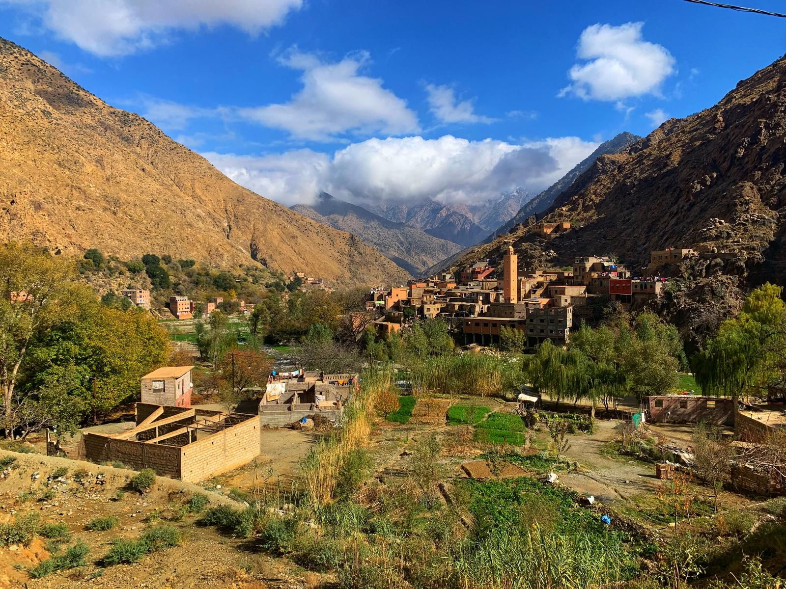
Ourika Valley
- First waterfall of Setti Fatma: about 30 minutes up, steep and rocky
- Village walks on mule paths: easy to moderate, half a day
- Trek from Imlil to Setti Fatma: three days over a pass above 3,100 m
- From Oukaïmeden: passes above 2,900 m towards Tacheddirt and the upper Ourika
- Best seasons: spring and autumn; start early in summer
- Guided walk and lunch with a Berber family: 60 EUR per person
Short answers
How much does a guided walk in the Ourika Valley cost?
A guided walk in the Ourika Valley with us costs 60 EUR per person, with a local guide and lunch in a Berber family home; transport from Marrakech is optional. It is a half-day village walk on mule paths, easy to moderate. On the private day trip, a local guide for the waterfalls costs 40 EUR per group for 1 to 7 people.
How hard is the hike to the Setti Fatma waterfalls?
The hike to the first Setti Fatma waterfall takes about 30 minutes from the village, at about 1,500 m, on a steep, rocky path where you sometimes use your hands. Going higher towards the other six falls is harder and needs a guide: a Wikiloc track for the seven waterfalls measures about 7.2 km with 488 m of ascent.
When is the best time to hike in the Ourika Valley?
The best time to hike in the Ourika Valley is spring, from March to May, for full waterfalls and green terraces, and autumn for calm, clear days. In summer, start early, because storms build in the afternoon and flash floods are the main risk. In winter the valley floor is fine for walking, but the high passes are under snow.
Can you trek from Imlil to the Ourika Valley?
Yes, the trek from Imlil to Setti Fatma in the Ourika Valley takes three days: Imlil to Tacheddirt over the Tizi n'Tamatert, Tacheddirt to Timichi over the highest pass, between 3,172 and 3,230 m depending on the source, then down to Setti Fatma. You need a mountain guide, mules and nights in village guesthouses or homes.
Hiking in the Ourika Valley ranges from a half-hour climb to a waterfall to a three-day trek across the High Atlas. There are three kinds of walks. The best known is the path to the seven waterfalls of Setti Fatma, at the end of the road at about 1,500 m: the first fall is about 30 minutes up, on a steep and rocky path. The second is the half-day walk between villages on mule paths, above terraced fields, easy to moderate and best done with a local guide. The third is the trek that links Imlil to Setti Fatma in three days over a pass above 3,100 m. Above the valley, the Oukaïmeden plateau adds high-altitude walks and passes down towards the upper Ourika. Spring and autumn are the best seasons, and the main danger is the flash flood after a thunderstorm. Our guided walk with lunch in a Berber family home costs 60 EUR per person.
We walk these paths with travellers all year round. This guide sorts the walks by effort, so you can pick one that suits your legs and your day, and it says plainly what each one asks of you.
Which walks can you do in the Ourika Valley?
There are six main options, from a 30-minute climb to the first Setti Fatma waterfall to a three-day trek from Imlil. Most visitors do the waterfall path or a half-day guided walk between villages; the high passes from Oukaïmeden and the Imlil trek are mountain routes that need a qualified guide.
| Walk | Start | Time | Level | Guide |
|---|---|---|---|---|
| First waterfall of Setti Fatma | Setti Fatma | About 30 minutes up | Short but steep and rocky | Recommended |
| The upper waterfalls | Setti Fatma | Half a day | Demanding, with sections where you use your hands | Necessary |
| Walk between villages with lunch | Villages on the slopes of the valley | Half a day | Easy to moderate | Included |
| Oukaïmeden plateau | Oukaïmeden, about 2,600 m | One to a few hours | Easy, but at altitude | Recommended to find the rock carvings |
| Oukaïmeden to the upper Ourika | Oukaïmeden | One day, about 6 hours | Mountain walk, pass above 3,100 m | Necessary |
| Trek from Imlil to Setti Fatma | Imlil | Three days | Mountain trek | Necessary, with mules |
Comparison: time, difficulty, season and guide
The first table tells you where to start. This one helps you choose according to what you can give: your time, your knees and the season of your trip.
| Walk | Total time | Honest difficulty | Best season | Avoid | Guide needed? |
|---|---|---|---|---|---|
| First waterfall | 1 to 1.5 hours return, with a break | Easy for a walker, awkward on the way down for weak knees | March to June | Stormy afternoons in July and August | No, but recommended |
| Upper waterfalls | Half a day | Hard: boulders, hands, faint path | Spring and early summer, in the morning | Wet or icy rock, stormy weather | Yes |
| Village walk | Half a day | Easy to moderate, no exposed sections | All year; early morning in summer | Rarely: we adapt the loop | Yes, included in our outing |
| Oukaïmeden plateau | As long as you like | Easy, but the altitude leaves you breathless | Spring to autumn; snow in winter | Snowstorm days | For the rock carvings |
| Oukaïmeden to Timichi or Tacheddirt | One day | Hard: climb to 3,000 m and above | Late spring to autumn | Winter and early spring (snow on the passes) | Yes, a mountain guide |
| Imlil to Setti Fatma | Three days | Moderate to strenuous, long days | Spring and autumn | Winter (high pass under snow) | Yes, a mountain guide and mules |
The Setti Fatma waterfalls in brief
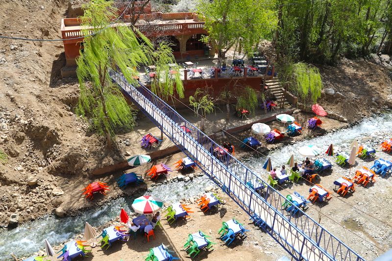
The path leaves the village, crosses the river on a footbridge and climbs through the boulders to the first of the seven falls. It takes about 30 minutes, and it is steeper than most visitors expect: in a few places you use your hands. Beyond the first fall the route becomes a real scramble, and most people turn back there. A track of the seven waterfalls recorded on Wikiloc measures about 7.2 km with 488 m of ascent, which gives an idea of the full circuit. The office of the official guides is near the bridge, where the walk begins.
The flow is strongest from March to May, with the snowmelt, and can shrink to a trickle by late summer. Our guide to the Setti Fatma waterfalls describes the path step by step, the flow month by month, swimming and the flood risk: read it before you go up.
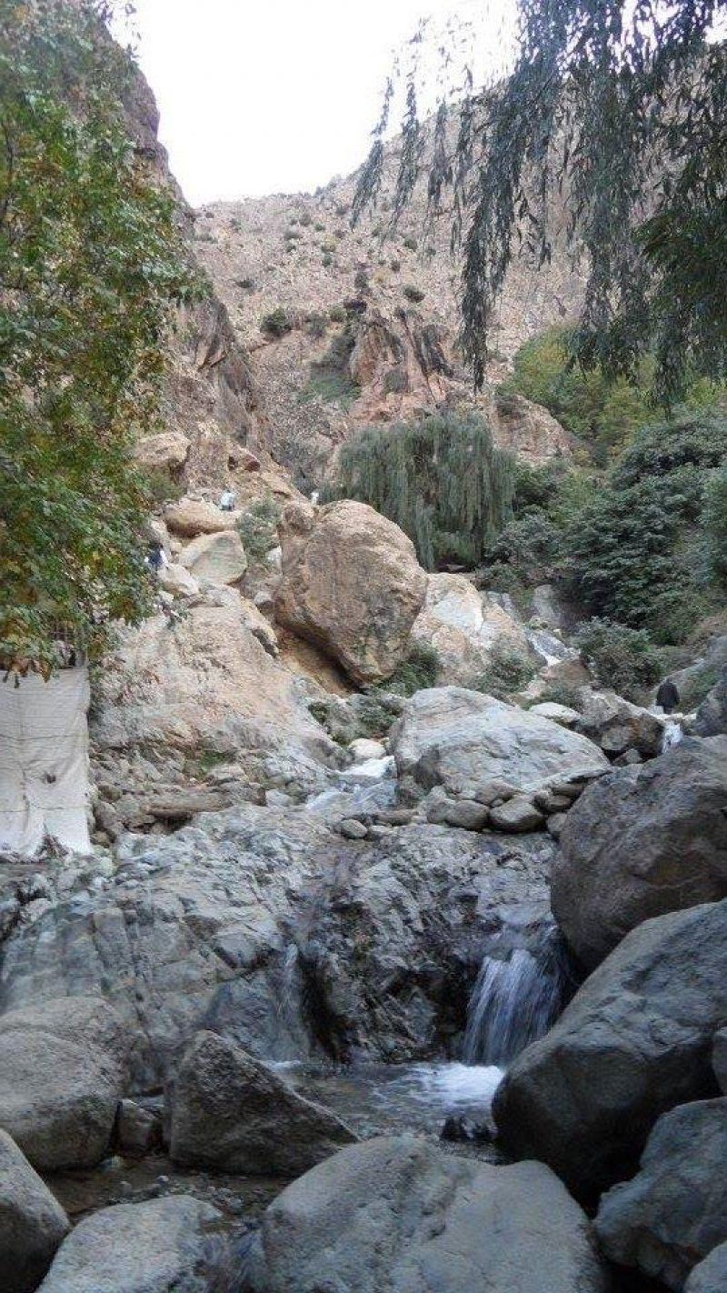
Walks between villages
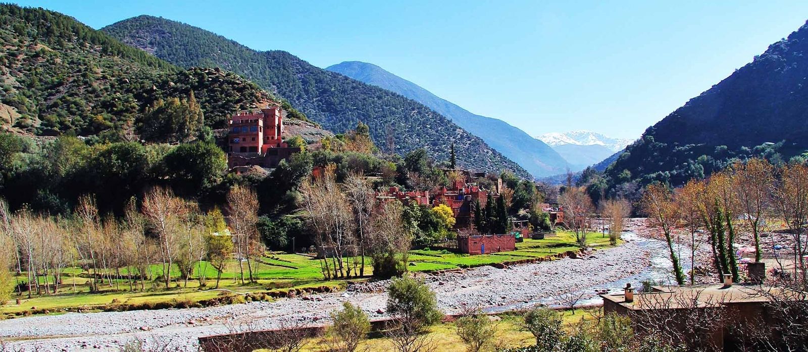
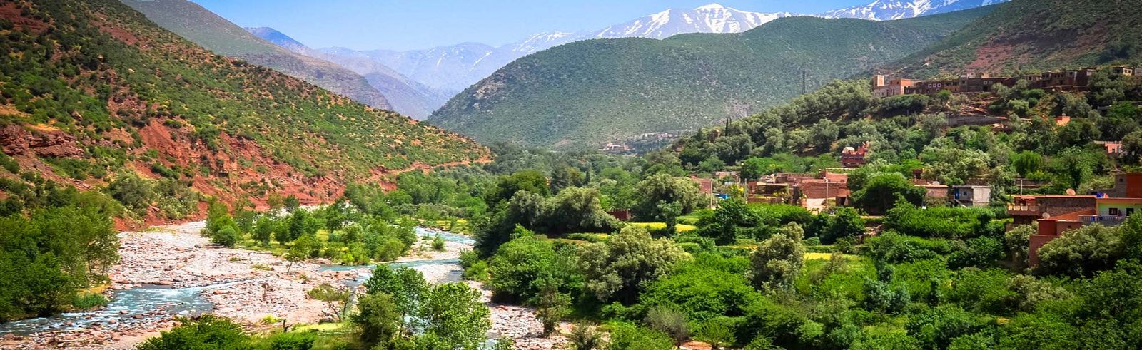
Away from the waterfall path the valley is quiet. Mule paths link the villages on the slopes, above terraced fields watered by irrigation channels, and a local guide leads you at an unhurried pace, with time to look at the houses, the walnut trees and the terraces. This is the walk we recommend to most travellers: it is easy to moderate, there are no crowds, and it ends at a family table. Our walk and lunch with a Berber family is exactly that: a private half-day with a guide from the valley and a home-cooked lunch, 60 EUR per person.
What the walk is actually like
There is no fixed route. Our guides choose the loop on the day, according to the weather, the season and the group, and they follow the paths the villagers use to reach their fields. This is how it usually goes:
- Meeting up. With the transport option, our driver collects you from your hotel or riad, and the drive to the valley takes about 1 hour. If you come on your own, we confirm the meeting point after you book.
- The climb to the villages. The path leaves the valley floor and climbs between the orchards. Expect ups and downs, stony stretches and a few narrow sections along the seguias, the channels that carry river water to the terraces.
- The stops. Your guide shows you how water passes from one terrace to the next, how the houses are built of rammed earth and stone, and why the roofs are flat. You share the path with mules and villagers.
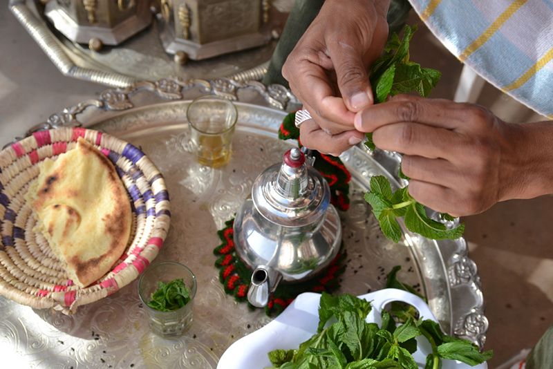
- Lunch. The walk ends in a family home: mint tea, bread from the clay oven, cooked salads and a tagine, then seasonal fruit.
There are no technical difficulties and no exposed sections: the walk suits families and travellers who do not walk much, as long as they are happy with a few slopes. In hot weather much of the walk is in the shade of the orchards. To understand the villages before you come, our page on the people and culture of the valley also gives a few words of Tashelhit to use on the way.
The trek from Imlil to Setti Fatma
The Ourika Valley is also the finishing point of a classic three-day trek from Imlil. A mountain guide's programme gives these stages:
| Day | Stage | Walking time | Highest point |
|---|---|---|---|
| 1 | Imlil (1,740 m) to Tacheddirt (2,400 m) | About 5 hours | Tizi n'Tamatert, 2,279 m |
| 2 | Tacheddirt to Timichi (2,000 m) | About 6 hours | Tizi n'Iabbassen, 3,172 m |
| 3 | Timichi to Setti Fatma | 4 to 5 hours | Downhill through the villages of the upper Ourika |
Where the programmes disagree
Compare several programmes and you will see the figures vary. The Rediscover Morocco programme calls the second day's pass the Tizi n'Tacheddirt and puts it at 3,200 m, with about 7 hours of walking that day, and allows 5 to 6 hours for the final descent. A track published on VisuGPX gives 3,230 m for the Tizi n'Tacheddirt and places Tacheddirt at 2,450 m, while others put it at around 2,300 or 2,400 m. Keep the overall picture in mind: a first pass at about 2,270 m, a second above 3,100 m, and days of 5 to 7 hours.
The same Rediscover programme describes the route in detail. From the Tizi n'Tamatert the path crosses pine and juniper woods, passes through the villages of Ouaneskra and Amghedoul, then reaches Tacheddirt. On the second day the climb to the pass takes about 2.5 hours, with views of Jbel Aksoual (3,842 m), Bou Iguenouane (3,882 m) and Angour (3,616 m), before the descent to Iabassene and on to Timichi, at the head of the Ourika Valley. The third day follows the valley east through Isghouarne and Agadir n'Aït Boulmane to Setti Fatma. This programme grades the trek 1 to 2, easy to moderate, and recommends proper walking boots and some experience.
Nights are spent in gîtes or village homes, and mules carry the bags. It is a real mountain trek, to be done with a qualified mountain guide, and not in winter when the high pass is under snow. We do not sell this trek; we can drive you to Imlil for the start or collect you at Setti Fatma at the end with our private transport. By road the two villages are about 75 km apart, as our page on getting to the valley explains. Our comparison of Ourika, Ouzoud and Imlil explains why Imlil is the base for hikers.
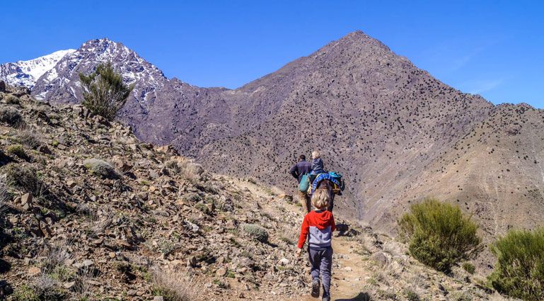
Hiking around Oukaïmeden
The Oukaïmeden plateau looks down on the valley: the road climbs up to it from Aghbalou, about 36 km away. Our guide to Oukaïmeden covers the road, the snow and the ski resort; here is what matters for walking.
On the plateau: easy, but high
At about 2,600 m the plateau offers walking without any serious climb: green pastures in spring and summer, stone shepherds' huts, boulders known to climbers and Bronze Age rock carvings. The carvings are scattered and easy to miss, so a local guide from the plateau who knows where they are is worth it. The air is cool even in summer, but the altitude leaves you breathless sooner than in Marrakech: walk slowly for the first few minutes and drink often.
The passes to Tacheddirt and the upper Ourika
The plateau is also the start of real mountain walks. Two hikers' sources describe these crossings:
| Route | Pass | Pass altitude | What the sources say |
|---|---|---|---|
| Oukaïmeden to Tacheddirt | Tizi n'Ouaddi | 2,954 m | Day 1 of the Angour loop on VisuGPX, which continues over the Tizi n'Tacheddirt (3,230 m) to Iabassene: about 19 km and 1,200 m of ascent |
| Oukaïmeden to Timichi | Tizi n'Ouattar | 3,130 m (VisuGPX) to 3,250 m (Rediscover) | About 6 hours: a track to a summer sheepfold, the climb to the pass among basalt rocks, then the descent through Timoummar and Anemiter to Timichi |
| Angour loop | Tizi n'Ouaddi, Tizi n'Tacheddirt, Tizi n'Ouattar | Up to 3,230 m | Two days from the CAF refuge at Oukaïmeden, about 27.6 km and 2,250 m of ascent in total |
Rediscover's five-day circuit linking Imlil, Oukaïmeden and the upper Ourika is graded "moderate to strenuous". These routes need a mountain guide, good fitness and passes clear of snow. We do not run them; our Ourika and Oukaïmeden day is a vehicle outing with free time on the plateau, not a trek.
What is the best season for hiking?
Spring, from March to May, is the best season: the waterfalls are full, the terraces are green and there is still snow on the summits. Autumn, from September to November, is the other good window, calm and clear. In summer walk early, before the afternoon storms, and in winter keep to the valley floor.
| Season | Conditions |
|---|---|
| Spring (March to May) | The best: water in the falls, green terraces, snow on the summits |
| Summer (June to August) | Cooler than Marrakech, but start early; thunderstorms in the afternoon |
| Autumn (September to November) | Calm and clear; storms still possible early in the season |
| Winter (December to February) | Cold and bright in the valley; high passes under snow |
To give you an idea, our weather page gives lows and highs in the lower valley of about 7/21 °C in April, 17/32 °C in July and August, and 11/24 °C in October. On the Oukaïmeden plateau, older records give an average high of about 22 °C in July and 5.5 °C in January: take a fleece even in summer. Check the Ourika Valley weather before you set out: our page has a live seven-day forecast for Setti Fatma.
How do you hike safely?
The main danger is the flash flood: after a storm upstream, the river can rise in minutes, so never walk in the riverbed when storms are forecast, and in summer be back in the village by early afternoon. Wear closed shoes with grip, carry water and a warm layer, and listen to the guides.
- Never walk in or along the riverbed when a storm is forecast. After a storm upstream the river can rise in minutes, as it did in October 2026.
- Listen to the guides and the villagers. When they tell you to come down, they mean it.
- Wear closed shoes with grip. The rock is polished and wet near the falls.
- Carry water and a warm layer. The valley is cooler than Marrakech and the weather changes fast.
- Start early. Mornings are cooler, quieter and safer.
Storms and floods: the afternoon rule
In July and August the heat building up over the mountains often sets off afternoon storms, and rain falling higher up can send a wave of water down the gorge while the sky above Setti Fatma still looks clear. The valley has not forgotten the flood of 17 August 1995. In early October 2026, storms again pushed mud and stones onto the Setti Fatma road, before the valley reopened as normal. Hence our rule: in summer, set off in the morning and be back in the village by early afternoon. If you hear thunder, if dark clouds gather over the peaks, or if the water turns brown or starts to rise, get out of the riverbed and climb up the slope. Never wait out a storm at the bottom of the gorge.
Choosing a guide
A guide is not compulsory on the path to the first waterfall, but in practice you need one as soon as you leave the busy paths. In Setti Fatma, go to the office of the official guides near the bridge rather than the touts on the road. For a trek, choose a trained mountain guide: the mountain training centre at Tabant, in the Aït Bouguemez valley, was set up as part of a French-Moroccan cooperation programme, and a 1999 study reported that more than two hundred Moroccan mountain guides had trained there. Do ask your guide where they trained.
In an emergency
In Morocco, the emergency numbers are dialled from within the country: 15 for the fire brigade and ambulance, 19 for the police and 177 for the Royal Gendarmerie. Mobile coverage is patchy in the gorge and on the passes: leave your route and expected return time with your hotel or riad, and do not set off alone off the busy paths.
What should you pack?
For the waterfalls or a village walk, closed shoes with a good grip (never flip-flops), clothes that cover shoulders and knees, a warm layer, water, sun cream and a small backpack are enough. For the Imlil trek or the Oukaïmeden passes, add broken-in walking boots, windproof layers, a head torch and walking poles.
| For | The village walk or the waterfalls | The trek or the passes |
|---|---|---|
| Feet | Trainers or walking shoes with a good tread, never flip-flops | Broken-in ankle walking boots |
| Body | Light clothes, shoulders and knees covered in the villages, a warm layer | Warm layers, windproof jacket, hat; thermal underwear recommended from December to May |
| Water and sun | A bottle of water, sun cream, hat | Water bottles, sunglasses, sun cream |
| Bag | A small backpack to keep your hands free | Small daypack; the mules carry the rest |
| Money | Small notes for drinks, the guide and the tip | Cash for purchases on the way and for tips |
| Other | Waterproof pouch for your phone near the falls | Head torch, small first-aid kit, walking poles |
Walking poles help a great deal on the way down, which is the hardest part for the knees, both on the waterfall path and coming off the passes.
How do you book a guided walk?
Book online with a 50% deposit and pay the balance to the driver on the day. Our walk and lunch with a Berber family costs 60 EUR per person, with optional transport from Marrakech at 120 EUR per vehicle for 1 to 7 people. Cancellation is free up to 48 hours before.
| Walk | Price | What is included |
|---|---|---|
| Walk and lunch with a Berber family | 60 EUR per person | Local guide, walk between villages, home-cooked lunch and tea |
| Transport from Marrakech for that walk | 120 EUR per vehicle for 1 to 7 people, 200 EUR for 8 to 17 | Private vehicle and driver, return |
| Local guide for the waterfalls, on the private day trip | 40 EUR per group for 1 to 7 people, 80 EUR for 8 to 17 | A guide from the valley for the waterfall walk |
Everything is booked online with a 50% deposit, the balance paid to the driver on the day, and free cancellation up to 48 hours before.
Two examples to give you an idea. Four people doing the walk with lunch and taking the transport pay 4 x 60 + 120 = 360 EUR, or 90 EUR each. A group of four who prefer the private day trip at 120 EUR per vehicle and add the local guide for the waterfalls at 40 EUR pay 160 EUR in total, or 40 EUR each, without lunch. If the weather makes the valley unsafe on your date, we offer another date or a full refund.
For a longer trek over several days elsewhere in the High Atlas, the Aït Bouguemez valley trek crosses the "Happy Valley" further east.
For what you may see along the way, read our guide to the nature and wildlife of the valley. For a walk at altitude without a climb, the Oukaïmeden plateau is easy ground at 2,600 m.
Sources
- Wikiloc, hiking routes at Setti Fatma: distance and ascent of the seven waterfalls circuit (in French)
- Ecotourisme Trek Maroc, Imlil to Setti Fatma trek in three days: stages, altitudes and walking times (in French)
- Rediscover Morocco, Imlil to Setti Fadma trek: stages, villages, Tizi n'Tacheddirt at 3,200 m, grade and equipment
- Rediscover Morocco, Imlil, Oukaïmeden and upper Ourika circuit: Tizi n'Ouattar and the stage to Timichi
- VisuGPX, Angour loop over the passes from Oukaïmeden: distances, ascents and pass altitudes (in French)
- Peyratout J. (1999), Rural tourism in the Moroccan mountains: mountain guides, CIHEAM-IAMM (FAO AGRIS record)
- Wikipedia, telephone numbers in Morocco: emergency numbers 15, 19 and 177
Frequently asked questions
Is the Ourika Valley good for hiking?
Yes, for easy and moderate walks. The valley has a short, steep climb to waterfalls, quiet paths between villages and terraces, and the end point of a multi-day trek. If serious mountain hiking is the only aim of your day, Imlil and the Toubkal massif make a better base.
How hard is the hike to the Setti Fatma waterfalls?
The first waterfall is about 30 minutes up from the village on a steep, rocky path where you sometimes use your hands. Going higher towards the other falls is harder and needs a guide. A track recorded on Wikiloc for the seven waterfalls measures about 7.2 km with 488 m of ascent.
Do you need a guide to hike in the Ourika Valley?
Not for the first waterfall, although a guide from the village makes the climb safer and more interesting. For the upper falls, the walks between villages and any trek, yes: the paths are not waymarked and the river changes after rain.
Can you walk from the Ourika Valley to Imlil?
Yes, in three days, usually in the direction Imlil to Setti Fatma: Imlil to Tacheddirt over the Tizi n'Tamatert, Tacheddirt to Timichi over a pass above 3,100 m, then down to Setti Fatma. You need a mountain guide, mules and nights in village guesthouses or homes.
When is the best time to hike in the Ourika Valley?
Spring, from March to May, for water in the falls and green terraces, and autumn for calm, clear days. In summer start early: storms build in the afternoon. In winter the valley floor is still good for walking, but the high passes are under snow.
How much does a guided walk cost?
Our walk with a local guide and lunch in a Berber family home costs 60 EUR per person, with transport from Marrakech as an option. On the private day trip, a local guide for the waterfalls costs 40 EUR per group for 1 to 7 people and 80 EUR for 8 to 17.
What should you wear to hike in the valley?
Closed shoes with good grip, never flip-flops, a warm layer because the valley is cooler than Marrakech, sun protection and water. In the villages, cover your shoulders and knees.
Can you hike from Oukaïmeden down to the Ourika Valley?
Yes, as a mountain walk. From the plateau, at about 2,600 m, one path crosses the Tizi n'Ouaddi (2,954 m) to Tacheddirt, and another the Tizi n'Ouattar, given as 3,130 to 3,250 m depending on the source, to Timichi in the upper Ourika in about 6 hours. Do these routes with a mountain guide and only when the passes are free of snow. On the plateau itself, the walk to the rock carvings is easy.
How long does the village walk take?
Half a day. Our guides choose the loop on the day according to the weather, the season and the group, at a slow pace, with ups and downs but no exposed sections. It ends with lunch in a family home.
Can children hike in the Ourika Valley?
Yes, on the village walk and up to the first waterfall, for children who are used to walking. Keep the youngest close on the rocky steps and by the water; a pushchair is no use beyond the village. The Imlil trek and the Oukaïmeden passes are not suitable for young children.
What should you do in an emergency while hiking?
In Morocco, dial 15 for the fire brigade and ambulance, 19 for the police and 177 for the Royal Gendarmerie. Mobile coverage is patchy in the gorge and on the passes: leave your route with your hotel and walk with a guide once you leave the busy paths.
What is the easiest walk in the valley?
The village walk with a local guide, easy to moderate and largely in the shade of the orchards. Walking on the Oukaïmeden plateau, at 2,600 m, is also easy, but the altitude leaves you breathless sooner. The climb to the first waterfall is short but steep.